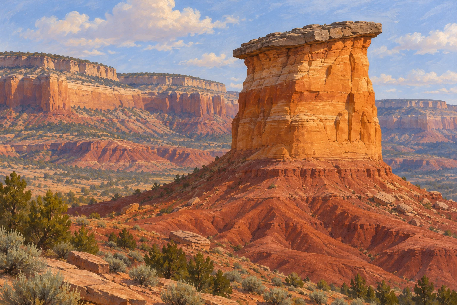
A sandstone tower near Grand Junction can look like a finished sculpture. Its outline is memorable, but the more interesting story begins before that outline existed. The rocks record older environments; the tower records later removal of surrounding material. Looking at those two histories separately makes Colorado National Monument more than a collection of spectacular shapes.
For a traveller from Botswana including western Colorado in a United States journey, this offers a manageable purpose for a landscape visit. Learn a few relationships between layers, then test your understanding against interpretation and the view from an appropriate public stopping place. You do not need to identify every formation or complete a demanding walk to notice how the landscape fits together.
Separate the age of the rock from the age of the view
The National Park Service's Geodiversity Atlas describes sedimentary rocks above much older basement rocks, with a substantial gap in the record between them. It also distinguishes the deposition of those sedimentary layers from the later uplift and erosion that shaped the monument's canyons. Rock formation and the making of today's landforms are different stages.
This distinction prevents a common shortcut in travel descriptions. A cliff made from ancient material did not necessarily possess its current shape throughout that material's history. The stone could exist long before a canyon exposed it, and a layer could once extend beyond the isolated piece now standing in front of you. The outline is an outcome to explain, rather than a starting condition to assume.
Use the view at two scales. First follow the broad arrangement of walls, slopes and detached towers. Then return to the bands within one wall. A photograph that includes the surrounding plateau can preserve the relationship between a solitary feature and the larger body of rock from which it became separated.
An interpretive rock column can help organise these observations, but it has a particular purpose. It arranges units vertically so their sequence is clear. It is not necessarily a portrait of the cliff visible beside you, and its colours need not reproduce the colours of every exposed surface.
Look for an older desert inside the sandstone
The park's Wingate Sandstone account describes fine sand deposited by wind in an ancient dune environment. Large cross-beds and very thin horizontal laminations help explain that origin. What appears from a distance to be one massive orange wall can therefore contain smaller patterns recording how sediment accumulated.
When an authorised viewpoint or displayed close-up makes those patterns visible, notice the difference between a formation's broad boundaries and its internal lines. Slanting laminae within a sandstone body need not mean that the whole landscape was tilted at the same angle. Interpretation can explain which scale of structure is being discussed.
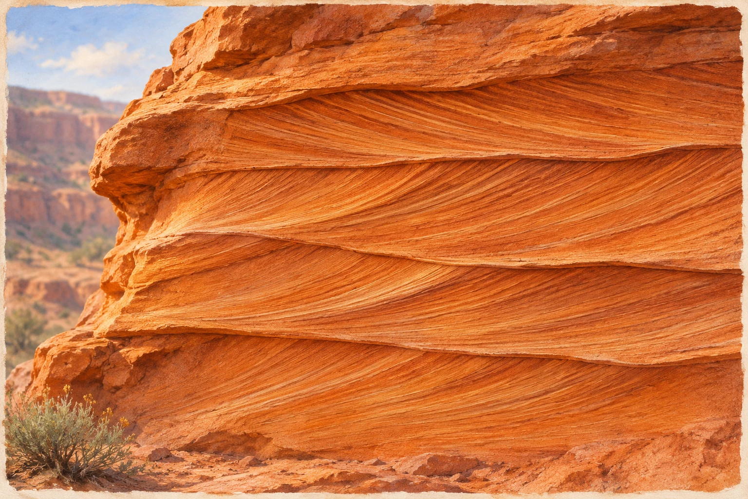
A useful photograph includes enough of the exposure to show where a pattern begins and ends. A very tight crop may be attractive while removing the relationship that made the detail meaningful. Keep a wider frame as well, and note the formation name only where a reliable label or guide establishes it.
The pleasure here is in connecting a small texture with a former environment. A present-day cliff and an ancient moving dune are very different sights, yet the arrangement of the grains provides a way to think between them. That connection is more informative than treating every stripe as a decorative band or inventing an exact wind history from one photograph.
Follow changing environments up the sequence
The park's Rock Layers guide associates the Chinle Formation with an older floodplain setting, the Wingate with dunes and the Kayenta with braided streams. These units record changes in the environments where material accumulated. Today's dry scenery should not be projected unchanged through the whole sequence.
Start with the order rather than trying to memorise a long list of dates. A name becomes easier to remember when it has a role in a story: material deposited in one setting, followed by material deposited in another. The rock column then becomes a framework for questions about change, rather than an examination to pass during a holiday.
The same guide describes the Kayenta as a common cap on monoliths and the Wingate as a major cliff-forming sandstone. It places the more easily eroded, dark red Chinle beneath the Wingate. Different appearances in the landscape are connected with different rock properties as well as with the original environments.
Try a simple comparison within a single permitted view. Which unit forms the steep face, which appears as a thinner ledge, and which occupies a gentler slope? Describe those relationships before attaching a formation name. If shadow or distance hides the boundary, leave the identification open instead of forcing the scene to match a remembered diagram.
Understand why some material remains standing
The Geodiversity Atlas explains differential erosion: rocks with different resistance are removed at different rates. Resistant layers can protect material beneath them. Its account of the monument's spires describes retreating cliffs and drainage cutting back into the plateau, eventually separating pieces that remain as towers.
This makes the empty space around a tower part of its story. The eye naturally follows the surviving stone, but the gaps and recesses also matter. Look between the feature and the neighbouring wall. Their relationship can suggest why the isolated shape belongs to a wider landscape, even when a visitor cannot reconstruct every stage of its development.
The US Geological Survey's description of its 2001 geological mapping likewise identifies the Kayenta as cap rock above the cliff-forming Wingate. That agreement supports the broad relationship; the linked technical map and report contain a more detailed investigation than a short scenic visit can reproduce.
Avoid turning the explanation into a prediction about a particular block or edge. Understanding that erosion shapes cliffs does not tell a visitor when material will move or where it is suitable to stand. Enjoy the pattern from designated places, follow current park directions and leave close inspection to the people responsible for the site.
Bring home relationships rather than a collection of names
The atlas notes that dark surface coatings, including desert varnish, can contrast with lighter sandstone beneath them. A dark streak on a cliff face is therefore not automatically a separate formation. Internal layers, surface coatings and shadows can produce different kinds of visible pattern.
That is a useful final check for a travel notebook. Keep three observations distinct: the outline of the landform, the arrangement inside the rock and the appearance of its exposed surface. Record what interpretation helped explain, and what remained uncertain from your actual viewpoint. A few accurate relationships will outlast a list of confidently misidentified stripes.
Check current park arrangements before setting out, including available roads, stopping places and any closures. Plan the outing around the time and mobility of your group. There is no need to approach an edge, leave a designated route or collect a fragment to make the geological story more complete.
The strongest memory may be a change in how you see. A tower becomes surviving material within a retreating landscape; a slanting line becomes a trace of deposition; a flat cap becomes part of an explanation for the shape below. Colorado National Monument rewards that patient attention with a story that reaches far beyond the first impressive silhouette.
Be the first to share a thought or travel tip.